- India
- Jul 22
Explainer / Recurring floods in Assam
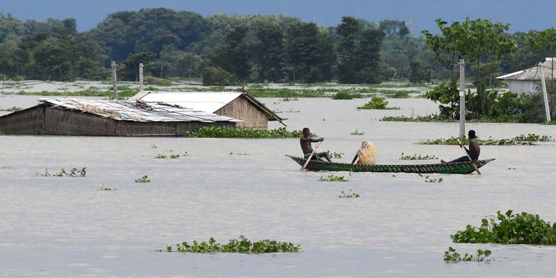
Floods continue to ravage Assam year after year, during monsoon affecting millions of lives. This year also the state is battling a flood amid the coronavirus pandemic.
Around 70 lakh people have been affected by the flood this year and killed more than 80 people. At least 24 out of the state’s 33 districts have been affected.
According to a Central Water Commission (CWC) bulletin, most rivers in the state continue to be in spate. The Brahmaputra, Dhansiri, Jia Bharali, Kopili, Beki, Kusiyara and Sankosh flowed above the danger mark at several places.
Rising water levels have submerged the Kaziranga National Park, home to the world’s largest concentration of one-horned rhinoceros. Around 2,500 of the world’s 3,000 one-horned rhinos live in Kaziranga.
Rivers flowing through Assam
Assam has two valleys and three major rivers flowing through it — Brahmaputra, Barak and Manas.
According to Rashtriya Barh Ayog (National Commission on Floods), 31.05 lakh hectares of the total 78.523 lakh hectares area of the state is prone to frequent floods (39.8 per cent of the total land area of Assam).
Compared to the entire country, the flood prone area in Assam is four times the national average.
Brahmaputra is the largest water carrying river of India and the second-largest silt carrying river in the world which originates from the Kailash ranges of the Himalayas.
It enters India through Arunachal Pradesh and flows through Assam and Bangladesh before it joins the Bay of Bengal. Its slope is steep till it enters India and due to drastic levelling out of the elevation, the river becomes braided when it enters the state.
Tributaries of the river are rain fed and swells abundantly with rain during the Southwest Monsoon. Some of them are: Subansiri, Kameng, Bhareli, Dhansiri, Manas, Champamati, Saralbhanga, and Sankosh Rivers.
Barak is another major river in Assam originating from the hills of Manipur and drains the southern part of the state.
Major reasons for recurring flood
1) Earthquakes and landslides: Northeast region is prone to frequent earthquakes which causes landslides. As a result, a lot of debris and silt are deposited in the river causing rise in the river bed.
2) Erosion: Around 4.27 lakh hectares of land has been eroded away by the Brahmaputra and its tributaries in the last six decades which is 7.40 per cent of the total area of the state. Such erosion costs damages to the tune of several hundred crores every year. It also reduces the fertile agricultural lands. The width of Brahmaputra at some places increases to 15 km.
3) Embankments not reinforced: Breach of embankments leads to flooding. More than 80 per cent of these embankments have not been reinforced in several decades due to administrative issues. Also, unplanned construction of embankments disrupt the natural flow of rivers.
4) River dams: Releasing of water from dams situated uphill triggers unregulated flow of water in the plains which affects the people in the state.
5) Encroachment of land and water bodies: The wetlands forests and local water bodies are getting destroyed and adds to the disaster vulnerability of the area.
6) Improper implementation of projects: Some of the proposed Brahmaputra river projects to strengthen the embankments dredge the river bed. Wetlands and forest areas are also not protected.
Manorama Yearbook app is now available on Google Play Store and iOS App Store

