- India
- Mar 09
ISRO receives Indo-US developed NISAR satellite
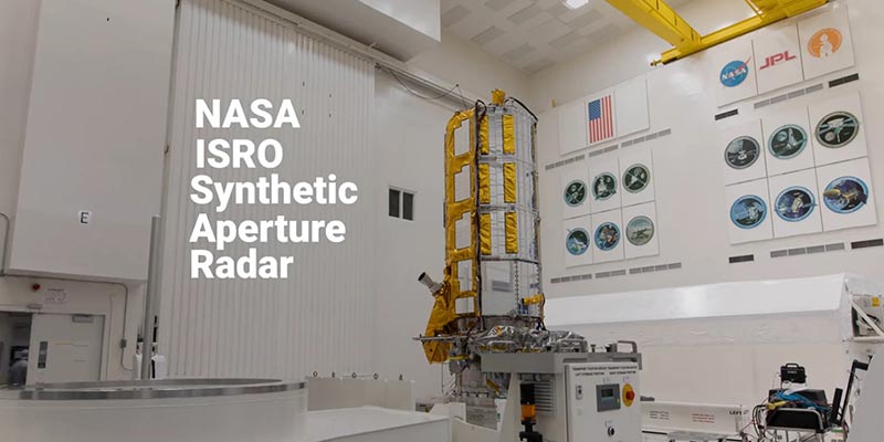
The US Air Force handed over NISAR, an earth observation satellite jointly developed by NASA and ISRO, to the Indian space agency.
The satellite is an outcome of a collaboration between the American space agency NASA and Indian Space Research Organisation (ISRO).
The satellite is expected to be launched in 2024 from Satish Dhawan Space Centre in Andhra Pradesh, into a near-polar orbit.
What is NISAR?
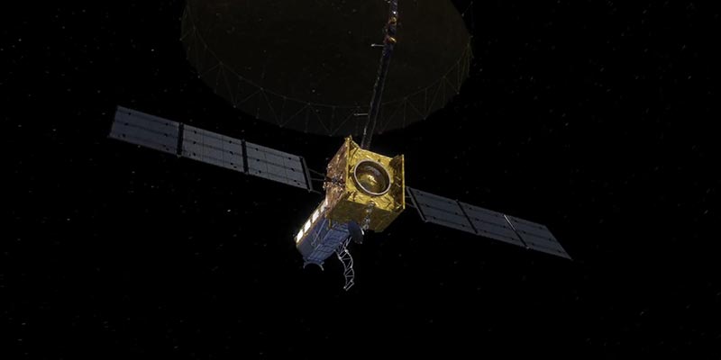
• The NASA-ISRO Synthetic Aperture Radar (NISAR) is a joint Earth-observing mission between NASA and ISRO with the goal to make global measurements of the causes and consequences of land surface changes using advanced radar imaging.
• On September 30, 2014, NASA and ISRO signed a partnership to collaborate on and launch NISAR.
• NISAR is planned to launch in 2024 from Satish Dhawan Space Center in Sriharikota into a near-polar orbit.
• The NISAR satellite is designed to observe and take measurements of some of the planet’s most complex processes. These include ecosystem disturbances, ice-sheet collapse, and natural hazards such as earthquakes, tsunamis, volcanoes and landslides.
Applications of NISAR
• NISAR is the first satellite mission to collect radar data in two microwave bandwidth regions, called the L-band and the S-band, to measure changes in our planet's surface less than a centimeter across.
• This allows the mission to observe a wide range of Earth processes, from the flow rates of glaciers and ice sheets to the dynamics of earthquakes and volcanoes.
• NASA is providing the mission’s L-band synthetic aperture radar, a high-rate communication subsystem for science data, GPS receivers, a solid-state recorder and payload data subsystem. ISRO is providing the spacecraft bus, the S-band radar, the launch vehicle and associated launch services.
• NISAR uses a sophisticated information-processing technique known as synthetic aperture radar (SAR) to produce extremely high-resolution images. Radar penetrates clouds and darkness, enabling NISAR to collect data day and night in any weather.
• NISAR will add a tremendous new data set to create new and greatly improve upon existing applications. By virtue of the planned frequent and regular sampling of some of the world’s most hazard-prone areas, these data will be a rich source of information to guide development of applications and their associated scientific studies.
• They will be a reliable data source over the life of the mission for proactive planning for disasters, and will have a store of pre-disaster images available to rapidly understand what transpired in the disaster, leading to the development of actionable applications that could inform the government for consideration of future operational missions.
• Water resource monitoring, infrastructure monitoring, and other value-added applications will also be revolutionised by access to these data.
• Over the course of multiple orbits, the radar images will allow users to track changes in croplands and hazard sites, as well as to monitor ongoing crises such as volcanic eruptions.
• The images will be detailed enough to show local changes and broad enough to measure regional trends. As the mission continues for years, the data will allow for better understanding of the causes and consequences of land surface changes, increasing our ability to manage resources and prepare for and cope with global change.
What is Synthetic Aperture Radar (SAR)?
• Synthetic Aperture Radar (SAR) refers to a technique for producing fine-resolution images from a resolution-limited radar system.
• The basic principle of any imaging radar is to emit an electromagnetic signal (which travels at the speed of light) towards a surface and record the amount of signal that bounces/echoes back and its time delay.
• The resulting radar imagery is built up from the strength and time delay of the returned signal, which depends primarily on the roughness and electrical conducting properties of the observed surface and its distance from the orbiting radar.
• The wavelengths that remote sensing radars use to observe Earth’s surface are microwaves, typically in the range of a few to tens of centimeters. Because the radar signal loses energy as it travels – at a rate equivalent to the beam width (wavelength/antenna size) – by the time it hits the surface, the beam has spread dramatically.
• For example, with a signal wavelength of 10 centimeters and an antenna of 10 meters in diameter, the beam width is 1/100 radians (0.6 degrees). From an altitude of 1,000 kilometers, the resulting beam width on the ground becomes a very large 10 km, producing an image resolution which is insufficient for most applications.
• SAR is the solution to this dilemma as it can vastly improve the resolution.
• SAR techniques take advantage of the fact that the radar is moving in orbit to synthesize a virtual 10-km-long antenna from the physical 10-m antenna in the direction of flight. As the radar moves along its path, it sweeps the antenna’s footprint across the ground while continuously transmitting pulses – short signal bursts separated by time – and receiving the echoes of the returned pulses.
Manorama Yearbook app is now available on Google Play Store and iOS App Store


