- India
- Oct 05
What is the role of National Center for Seismology?
• Four earthquakes, the strongest being of magnitude 6.2, jolted Nepal in quick succession on October 3 with tremors reverberating through parts of north India, including Delhi-NCR, the National Centre for Seismology (NCS) said.
• The epicenter of the strongest quake was located in Dipayal district in west Nepal, 206 km southeast of the pilgrimage town of Joshimath in Uttarakhand and 284 km north of Uttar Pradesh’s capital Lucknow.
• Tremors were felt in Chandigarh, Jaipur and other parts of north India as well. Tremors were also felt at various places in Uttarakhand, including Pauri, Chamoli, Uttarkashi, Haridwar and Pithoragarh.
• The events were recorded by more than 60 broadband seismic stations installed by the National Centre for Seismology.
• Nepal lies in one of the most active tectonic zones (seismic zone IV and V) of the world, making the country extremely vulnerable to earthquakes.
National Center for Seismology
• The history of instrumental earthquake monitoring in India dates back to 1898 when the first seismological observatory of the country was established at Alipore (Calcutta) on December 1, 1898 after the great Shillong plateau earthquake of 1897.
• National Center for Seismology (NCS) is the nodal agency of the government of India for monitoring earthquake activity.
• NCS maintains a National Seismological Network (NSN) of 155 stations for real time monitoring of earthquake activities in and around the country.
• Each station has state-of-the-art equipment consisting of seismic broadband velocity sensor, accelerometer and data acquisition systems to monitor earthquake activity through its 24x7 monitoring center.
• NCS also monitors earthquake swarm and aftershock by deploying a temporary observatory close to the affected region.
• This system has latest tools for dissemination of earthquake information to the concerned disaster management authorities and other user agencies in least possible time for relief and rescue operations in hour of need.
• Apart from earthquake monitoring, NCS is also actively involved in the Seismic Hazard Microzonation and seismological research.
Major activities of NCS are:
• Earthquake monitoring on 24x7 basis.
• Operation and maintenance of National Seismological Network.
• Maintenance of seismological data centre and information services.
• Seismic hazard microzonation related studies.
• Aftershock/earthquake swarm monitoring/survey.
• Understanding of earthquake processes.
• Public outreach.
Some terms related to earthquake
Earthquake: An earthquake is a sudden, rapid shaking of the ground caused by the shifting of rocks deep underneath the earth’s surface. Earthquakes can cause fires, tsunamis, landslides or avalanches. Earthquakes are classified as, Slight (M<5.0), Moderate (5.0<M<6.9) and Great (M>7.0) depending upon the magnitude on the Richter scale. An earthquake having a magnitude, M<2.0 is termed as a microearthquake.
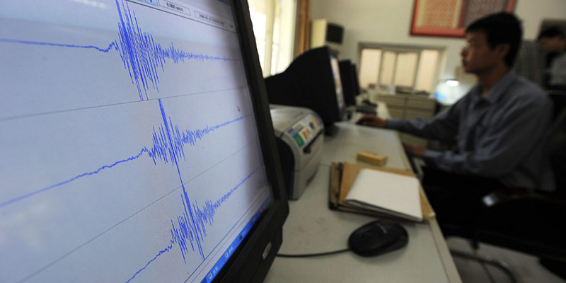
Seismograph: A seismograph, or seismometer, is an instrument used to detect and record earthquakes. Generally, it consists of a mass attached to a fixed base. During an earthquake, the base moves and the mass does not. The motion of the base with respect to the mass is commonly transformed into an electrical voltage. The electrical voltage is recorded on paper, magnetic tape, or another recording medium. This record is proportional to the motion of the seismometer mass relative to the earth, but it can be mathematically converted to a record of the absolute motion of the ground. Seismograph generally refers to the seismometer and its recording device as a single unit.
Richter scale: The Richter magnitude scale was developed in 1935 by Charles F. Richter of the California Institute of Technology as a mathematical device to compare the size of earthquakes. The magnitude of an earthquake is determined from the logarithm of the amplitude of waves recorded by seismographs. Adjustments are included for the variation in the distance between the various seismographs and the epicenter of the earthquakes. On the Richter Scale, magnitude is expressed in whole numbers and decimal fractions. For example, a magnitude 5.3 might be computed for a moderate earthquake.
Epicenter: It is the point on the surface of the Earth, vertically above the place of origin (hypocenter or focus) of an earthquake.
Aftershock: An earthquake that follows a large magnitude earthquake called, “main shock” and originates in or around the rupture zone of the main shock. Generally, major earthquakes are followed by a number of aftershocks, which show a decreasing trend in magnitude and frequency with time.
Manorama Yearbook app is now available on Google Play Store and iOS App Store

