- India
- Dec 20
Govt launches National Geoscience Data Repository portal
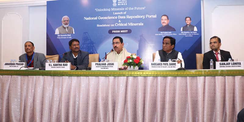
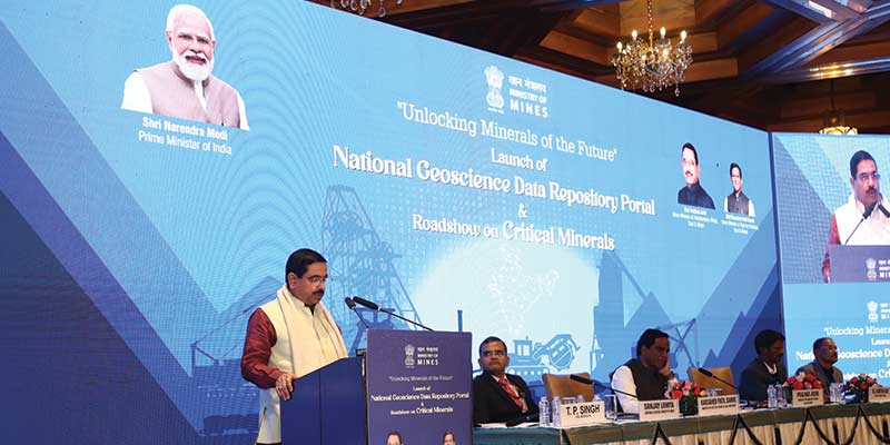
Union Minister Pralhad Joshi launched the National Geoscience Data Repository (NGDR) portal on December 19.
It is a comprehensive online platform for accessing, sharing, and analysing geospatial information across the nation.
National Geoscience Data Repository
• Globally, all the mineral-rich countries have a robust geoscience data portal having various layers of geoscientific information — geological, geophysical, geochemical, etc to support their mineral exploration programmes.
• The National Geoscience Data Repository (NGDR) initiative, spearheaded by Geological Survey of India (GSI) and Bhaskaracharya Institute of Space Applications and Geoinformatics (BISAG-N) represents a significant leap forward in democratising critical geoscience data, empowering stakeholders across industries and academia with unprecedented access to invaluable resources.
• The creation of NGDR was conceptualised by the ministry of mines as part of the National Mineral Exploration Policy (NMEP) 2016.
• The NGDR has been created, as a part of the National Mineral Exploration Policy, 2016, hosting all baseline and exploration-related geoscientific data in a single Geographic Information System (GIS) platform, to expedite, enhance and facilitate the exploration coverage of the country.
• The greater goal of this initiative is to increase the investment attractiveness of the mining sector in India.
• As the geoscience data through this portal will be available globally for viewing, downloading and interpretation, it will facilitate global mining companies to invest in India and bring new technologies in mineral exploration.
• Currently, 35 map services like geological, geochemical and geophysical, data layers have been incorporated with the NGDR portal.
• These data sets can be viewed, accessed and downloaded.
• This interplay of different geo-layers and further interpretation helps in targeting potential mineral zones.
• The NGDR portal can be accessed through https://geodataindia.gov.in.
• The NGDR will make available all geological, geochemical, geophysical and mineral exploration data in public domain on a digital geospatial platform.
• This will include baseline geoscience data and all mineral exploration information generated by various central and state government agencies and mineral concession holders.
• With this state-of-the-art, user-friendly, interoperable platform, India is now in the league of other mineral-rich countries where the accessibility of geoscientific data plays a vital role in fostering their mineral exploration programmes.
Key features of NGDR:
• Centralised access: Provides a centralised repository of diverse geoscience datasets, including geological maps, mineral resources, seismic data, and environmental information.
• User-friendly interface: An intuitive interface designed to cater to a wide range of users, enabling seamless navigation and exploration of data.
• MERT template: The Mineral Exploration Reporting Template (MERT) facilitates all the geoscientific stakeholders to submit their data in the NGDR portal in a standard reporting template.
• Analytical tools: Equipped with state-of-the-art analytical tools to interpret and extract valuable insights from complex geospatial data.
• Open access: Encourages transparency and knowledge sharing by offering open access to a wealth of geoscience information.
The Geological Survey of India
• The Geological Survey of India (GSI) was set up in 1851 primarily to find coal deposits for the Railways. Over the years, GSI has not only grown into a repository of geo-science information required in various fields in the country but has also attained the status of a geo-scientific organisation of international repute.
• Its main functions relate to creating and updating of national geoscientific information and mineral resource assessment. These objectives are achieved through ground surveys, air-borne and marine surveys, mineral prospecting and investigations, multi-disciplinary geoscientific, geo-technical, geo-environmental and natural hazards studies, glaciology, seismotectonic study and carrying out fundamental research.
• GSI’s core competence in survey and mapping is continuously enhanced through accretion, management, coordination and utilisation of spatial databases (including those acquired through remote sensing).
• GSI uses the latest computer-based technologies for dissemination of geoscientific information and spatial data, through cooperation and collaboration with other stakeholders in the geo-informatics sector.
• Headquartered in Kolkata, GSI is an attached office to the ministry of mines and has regional offices in Lucknow, Jaipur, Nagpur, Hyderabad and Shillong. GSI also has unit offices in almost all states of the country.
What is BISAG-N?
• Bhaskaracharya National Institute for Space Applications and Geo-informatics (BISAG-N) is an autonomous scientific society registered under the Societies Registration Act, 1860 under the ministry of electronics & information technology (MeitY).
• BISAG-N has three main domain areas: satellite communication, geo-informatics and geo-spatial technology.
• Bhaskaracharya Institute of Space Applications and Geoinformatics (BISAG), located in Gandhinagar, was a state agency of the department of science and technology, government of Gujarat. It was elevated as BISAG-N under MEItY this year.
• Beyond the mapping of the geographical features, BISAG-N helps ministries/departments of the central as well as state governments to apply geo-spatial technologies in an innovative manner, to improve the effective roll out of e-governance services for the common citizens.
Manorama Yearbook app is now available on Google Play Store and iOS App Store


