- India
- Feb 05
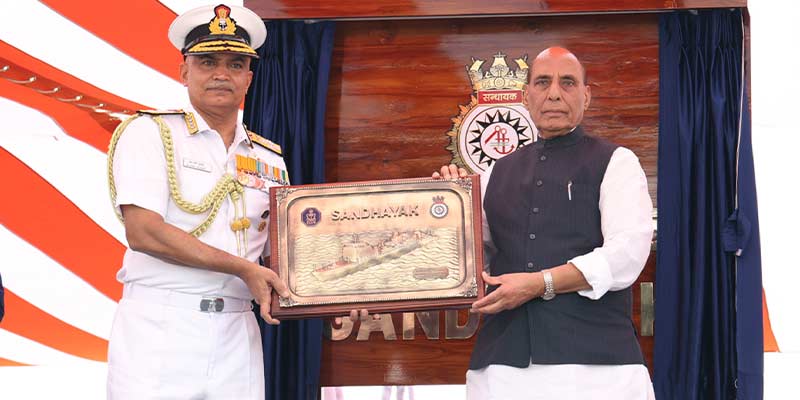
Defence Minister commissions INS Sandhayak into Navy
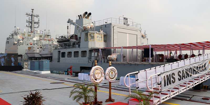
INS Sandhayak, the first of four Survey Vessel Large (SVL) ships, was commissioned into the Indian Navy at the Naval Dockyard in Visakhapatnam.
The primary role of INS Sandhayak is to carry out full scale hydrographic surveys of ports, harbours, navigational channels, routes, coastal areas and deep seas to enable safe marine navigation.
INS Sandhayak was built at Garden Reach Shipbuilders & Engineers (GRSE), Kolkata. This project was steered by the Warship Design Bureau of the Indian Navy.
Named after the Navy’s oldest Hydrographic Survey Vessel
• INS Sandhayak is the reincarnation of another ship by the same name, which was also a survey vessel. That ship had been commissioned into the navy in 1981 and decommissioned in 2021.
• The old ship undertook over 200 major hydrographic surveys in the western and eastern coasts of the Indian peninsula, the Andaman Sea and in neighbouring countries, including Sri Lanka, Myanmar and Bangladesh.
• It also took part in important operations like ‘Operation Pawan’ in Sri Lanka, 1987, ‘Rainbow for Humanitarian Assistance’ in the aftermath of the tsunami in 2004 and the maiden Indo-US HADR (humanitarian assistance and disaster relief) Exercise ‘Tiger-Triumph’ in 2019.
• The old Sandhayak was also built by GRSE.
Features of the new ship
• The ship has a displacement of 3,400 tonnes and an overall length of 110 meters with a beam of 16m.
• Sandhayak is fitted with state-of-the-art hydrographic equipment such as Data Acquisition and Processing System, Autonomous Underwater Vehicle, Remotely Operated Vehicle, Differential Global Positioning System (DGPS) long range positioning systems, digital side scan sonar, etc. Powered by two diesel engines, the ship is capable of achieving speeds in excess of 18 knots.
• These survey ships are capable of full scale coastal and deep-water hydrographic survey of ports and harbour approaches and determination of navigational channels and routes.
• These ships can undertake surveys of maritime limits and collection of oceanographic and geographical data for defence applications.
• In its secondary role, the ship can be converted into a hospital ship for requirements during wars or other emergency situations and can also provide limited defence.
What is hydrography?
• Hydrography deals with the measurement and description of the physical features of oceans, seas, coastal areas, lakes and rivers, as well as with the prediction of their change over time, for the primary purpose of safety of navigation and in support of all other marine activities, including economic development, security and defence, scientific research and environmental protection.
• In addition to supporting safe and efficient navigation of ships, hydrography underpins almost every other activity associated with the sea, including:
i) Resource exploitation (fishing, minerals)
ii) Environmental protection and management
iii) Maritime boundary delimitation
iv) National marine spatial data infrastructure
v) Recreational boating
vi) Maritime defence and security
vii) Tsunami flood and inundation modelling
viii) Coastal zone management
ix) Tourism
x) Marine science.
What is the significance of hydrographic survey?
• In the past, many artisanal shelters and fishing ports were built at convenient locations, with no particular attention paid to such environmental factors as wave heights, sudden changes in water depths, uncharted reefs, currents, tidal streams, seaweed and mobile beaches (sand drift).
• Many of the structures were subsequently expanded and, in countless cases around the world, many of the problems that used to be considered minor have now developed into major ones, with some shelters, for example, fouling up with seaweed or silting up (shelter mouth facing the wrong direction) or just being inaccessible in rough weather (reefs too close to entrance channel).
• A hydrographic survey, also known as a bathymetric survey, is therefore essential if the correct design decisions are to be made right from the project inception stage to ensure that the landing is easy to use and free of major maintenance problems under all conditions.
• Hydrographic surveys are required for a wide variety of purposes, ranging from simple reconnaissance (at project formulation, for instance) to payment for work carried out underwater, such as dredging or reclamation.
• The results from a hydrographic survey are normally plotted to produce a bathymetric contour map, which is a plan of the depth of the sea bed arranged in such a manner as to show lines of equal depth from the coastline.
Hydrographic surveys in India
• The Indian Naval Hydrographic Department (INHD) functions under the chief hydrographer to the government of India.
• The department, being the nodal agency for hydrographic surveys and nautical charting in India, has a very well-established organisational setup.
• The INHD has indigenously built modern survey ships including one Catamaran Hull Survey Vessel (CHSV) fitted with state-of-the-art surveying equipment.
• The National Hydrographic Office, situated in Dehradun, is mandated with the responsibility of publication of nautical charts and other publications for navigation at sea.
• The National Institute of Hydrography (NIH), Goa, an integral part of the INHD, has the national responsibility for conduct of hydrographic training and functions under the overall professional supervision of the chief hydrographer.
• Surveys are conducted in strict compliance with the International Hydrographic Organisation (IHO) standards. The department also pioneered in making official Electronic Navigational Charts (ENCs) for Indian waters.
• INHD is committed to capacity building in the Southeast Asian region and conducts training to personnel from countries in the region and some of the African nations.
• The department has also signed MoU with various countries for surveying their waters as part of international cooperation.
Manorama Yearbook app is now available on Google Play Store and iOS App Store


