- India
- Nov 15
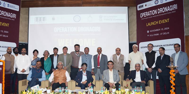
Govt launches ‘Operation Dronagiri’
The Department of Science and Technology (DST) launched ‘Operation Dronagiri’ on November 14.
It is a pilot project under National Geospatial Policy, 2022 to demonstrate the potential applications of geospatial technologies and innovations in improving the quality of life of citizens and ease of doing business.
What is geospatial technology?
• Geospatial technology makes use of satellite navigation systems and computer databases to create, capture, store and retrieve geographic and spatial information of any place. It enables efficient, effective, relevant and integrated planning through the use of real time data and data analytics.
• Geospatial technology has applications in almost every domain of the economy ranging from agriculture to industries, development of urban or rural infrastructure, administration of land, economic activities of banking and finance, resources, mining, water, disaster management, social planning, delivery services, etc.
• Geospatial data is now widely accepted as a critical national infrastructure and information resource with proven societal, economic and environmental value that enables government systems and services, and sustainable national development initiatives.
Operation Dronagiri
• ‘Operation Dronagiri’ is part of the numerous efforts of DST in liberalising geospatial data, developing geospatial infrastructure, geospatial skill and knowledge as well as standards in implementing the policy.
• The activities under Operation Dronagiri will be overseen by IIT Tirupati Navavishkar I-Hub Foundation (IITTNiF). The Geospatial Innovation Accelerators (GIAs) at IIT Kanpur, IIT Bombay, IIM Calcutta and IIT Ropar will act as the operational arms of Operation Dronagiri.
• The entire implementation process will be driven by Geospatial Innovation Cell, Department of Science and Technology.
• In the first phase, Operation Dronagiri will be implemented in the states of Uttar Pradesh, Haryana, Assam, Andhra Pradesh and Maharashtra, where pilot projects will be run and use cases will be demonstrated to showcase the potential applications of integration of geospatial data and technology in three sectors — agriculture, livelihoods, and logistics and transport.
• Several government departments, industry, corporate and startups will be partnered with in the first phase. This will create the base for its nationwide rollout.
Geospatial Data Sharing Interface (GDI)
• Operation Dronagiri gains a powerful backbone with support from Integrated Geospatial Data Sharing Interface (GDI), that will make spatial data accessible, bringing transformation similar to the process in which Unified Payments Interface (UPI) has brought about financial inclusion.
• The Integrated Geospatial Data Sharing Interface (GDI) enables seamless data sharing, access, and analysis for urban planning, environmental monitoring, disaster management, and more.
• Built with advanced data exchange protocols and privacy-preserving features, it empowers organisations to make data-driven decisions for the public good, fostering innovation and responsible use of geospatial data.
• GDI offers tools to unlock actionable insights and drive collaboration. It enables efficient data processing, analysis, and sharing among stakeholders.
• This collaboration ensures faster, more coordinated responses in areas like infrastructure monitoring, disaster relief, and environmental protection.
• Operation Dronagiri represents a crucial step within the National Geospatial Policy, designed to position India as a global leader in geospatial technology.
National Geospatial Policy, 2022
• The government of India notified the National Geospatial Policy (NGP) on December 22, 2022 with a vision to make India a world leader in global geospatial space.
• The government is implementing the Policy, and has substantially expanded the access and usage of spatial data, improving citizens services rapidly and increasing it’s reach to the remotest corners of the country.
• It is a citizen-centric policy that seeks to strengthen the geospatial sector to support national development, economic prosperity and a thriving information economy.
• The Policy builds on a conducive environment generated by the “Guidelines for acquiring and producing Geospatial Data and Geospatial Data Services including Maps” in February 2021, issued by Department of Science and Technology (DST).
• While the guidelines deregulated the geospatial sector by liberalising geospatial data acquisition/production/access, the Policy takes it further by laying down an overarching framework for holistic development of the geospatial ecosystem.
• It spells out the vision, goals for the geospatial sector and outlines the strategies for achieving them.
• It seeks to develop geospatial infrastructures, geospatial skill and knowledge, standards, geospatial businesses, promote innovation and strengthen the national and sub-national arrangements for generation and management of geospatial information.
• The Policy puts a core focus on innovation, as it aims to create a robust innovation ecosystem in the country.
• The geospatial data acquisition/production/access will continue to be governed by the guidelines in its present form or as stipulated by DST from time to time with an aim to promote private sector participation through continued enhancements of Ease of Doing Business in the sector.
• The citizen-centric Policy is also empowering local companies to generate and utilise their own geospatial data, enabling innovations and promoting technology innovation and adoption by establishing incubation centers, industry accelerators as well as Geospatial Technology Parks.
Manorama Yearbook app is now available on Google Play Store and iOS App Store

