- India
- Dec 19
- Kevin Savio Antony
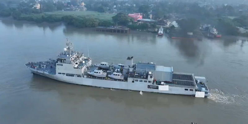
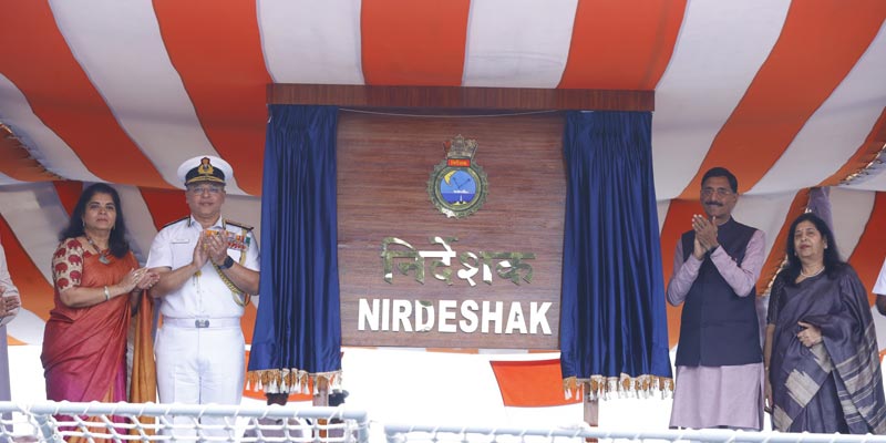
Indian Navy commissions INS Nirdeshak
Minister of State for Defence Sanjay Seth presided over the commissioning of INS Nirdeshak, the second Survey Vessel (Large) ship, at the Naval Dockyard in Visakhapatnam on December 18.
Vice Admiral Rajesh Pendharkar, Flag Officer Commanding-in-Chief of the ENC, hosted the commissioning ceremony.
Key points:
• Constructed by Garden Reach Shipbuilding & Engineers (GRSE), Kolkata, INS Nirdeshak is part of a four-ship series designed to advance India’s maritime capabilities.
• INS Nirdeshak, the second vessel under the Survey Vessel (Large) Project, marked a significant stride in India’s Aatmanirbhar Bharat initiative with over 80 per cent indigenous content.
• INS Sandhayak, the first of four Survey Vessel Large (SVL) ships, was commissioned into the Indian Navy in February 2024.
• The vessel’s primary mission includes conducting hydrographic surveys, assisting in navigation, and supporting critical maritime operations.
• Its secondary roles involve functioning as a hospital ship and participating in Humanitarian Assistance and Disaster Relief (HADR) missions.
• INS Nirdeshak inherits its legacy from its predecessor of the same name, which served the Indian Navy with distinction for over three decades before being decommissioned on December 19, 2014.
• INS Nirdeshak’s commissioning marks another milestone in India’s journey towards self-reliance in maritime technology while bolstering the Navy’s operational readiness and outreach.
INS Nirdeshak boasts state-of-the-art hydrographic systems, including:
• Multi Beam Echo Sounders
• Side Scan Sonars
• Autonomous Underwater Vehicles (AUV)
• Remotely Operated Vehicles (ROV).
• These systems enable precise mapping, safe navigation, and enhanced survey capabilities in challenging terrains.
• They also support environmental studies, marine resource exploitation, and wreck identification.
• Additionally, the ship accommodates one Advanced Light Helicopter (ALH), broadening its operational scope.
Hydrographic surveys facilitated by INS Nirdeshak will contribute to:
• Resource exploitation, including fishing and mineral exploration.
• Environmental protection and coastal zone management.
• Maritime boundary delimitation and defence.
• Development of the National Marine Spatial Data Infrastructure (MSDI).
• Coastal tourism promotion and marine research.
• Tsunami and flood modelling for disaster preparedness.
(The author is a trainer for Civil Services aspirants.)


