- India
- Jul 31
NASA, ISRO launch NISAR satellite
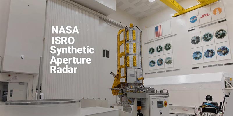
• India and the US marked their maiden space collaboration with the successful launch of NASA-ISRO Synthetic Aperture Radar (NISAR) satellite aboard ISRO's Geosynchronous Satellite Launch Vehicle (GSLV) on July 30.
• The 51.7 metre tall launch vehicle carrying the 2,393 kg satellite majestically lifted-off from the second launch pad at the Satish Dhawan Space Centre in Sriharikota.
• GSLV F-16 injected NISAR into the intended Sun Synchronous Polar Orbit (SSPO), after a flight of about 19 minutes and around 745 km.
What is NISAR?
• The NASA-ISRO Synthetic Aperture Radar (NISAR) satellite is a joint Earth-observing mission between NASA and ISRO with the goal to make global measurements of the causes and consequences of land surface changes using advanced radar imaging.
• On September 30, 2014, NASA and ISRO signed a partnership to collaborate on and launch NISAR.
• The NISAR satellite is designed to observe and take measurements of some of the planet’s most complex processes.
• NISAR will use two advanced radar instruments to track changes in Earth’s forests and wetland ecosystems, monitor deformation and motion of the planet’s frozen surfaces, and detect the movement of Earth’s crust down to fractions of an inch — a key measurement in understanding how the land surface moves before, during, and after earthquakes, volcanic eruptions, and landslides.
• It is the first satellite mission to collect radar data in two microwave bandwidth regions, called the L-band and the S-band, to measure changes in our planet’s surface less than a centimeter across.
• The L-band radar excels at measuring soil moisture, forest biomass, and motion of land and ice surfaces, while S-band radar excels at monitoring agriculture, grassland ecosystems, and infrastructure movement.
• This allows the mission to observe a wide range of Earth processes, from the flow rates of glaciers and ice sheets to the dynamics of earthquakes and volcanoes.
• NASA provided the mission’s L-band synthetic aperture radar, a high-rate communication subsystem for science data, GPS receivers, a solid-state recorder and payload data subsystem.
• ISRO provided the spacecraft bus, the S-band radar, the launch vehicle and associated launch services.
• NISAR uses a sophisticated information-processing technique known as Synthetic Aperture Radar (SAR) to produce extremely high-resolution images. The radar penetrates clouds and darkness, enabling NISAR to collect data day and night in any weather.
• The NISAR radar satellite mission will offer detailed insights into two types of ecosystems — forests and wetlands — vital to naturally regulating the greenhouse gases in the atmosphere that are driving global climate change.
• When in orbit, NISAR’s sophisticated radar systems will scan nearly all of Earth’s land and ice surfaces twice every 12 days.
• The data it collects will help researchers understand two key functions of both ecosystem types — the capture and the release of carbon.
• Forests hold carbon in the wood of their trees, wetlands store it in their layers of organic soil. Disruption of either system, whether gradual or sudden, can accelerate the release of carbon dioxide and methane into the atmosphere.
• Tracking these land-cover changes on a global scale will help researchers study the impacts on the carbon cycle, the processes by which carbon moves between the atmosphere, land, ocean, and living things.
• The data from the NISAR mission would provide critical insights to help governments and decision-makers plan for natural and human-caused hazards.
• NISAR can help with hazard-monitoring efforts and potentially give decision-makers more time to prepare for a possible disaster.
Manorama Yearbook app is now available on Google Play Store and iOS App Store


