- World
- Jul 10
Texas flash floods expose challenges in early warning
The flash floods in central Texas, that claimed more than 100 lives over the July Fourth weekend in the United States, highlights the dangers of this major hazard and the challenges in ensuring that early warnings reach those who need them.
What are flash floods?
• Flash floods are the most lethal form of flooding, responsible for over 5,000 deaths annually. According to World Meteorological Organisation (WMO) data, flash floods cause economic losses of more than $50 billion annually.
• Accounting for approximately 85 per cent of flooding cases, flash floods also have the highest mortality rate among different classes of flooding, including riverine and coastal.
• A flash flood is defined as a sudden, high-intensity flood event where the time between the triggering event (typically intense rainfall) and the onset of flooding is within a few hours.
• These events are characterised by rapid water level rise, high peak discharge, and often devastating impacts on infrastructure and communities, especially in urban and mountainous areas.
• Unlike slow-onset river floods, flash floods leave very limited time for reaction, making accurate short-term forecasting and community preparedness essential.
• Flash floods are not new, but their frequency and intensity are increasing in many regions due to rapid urbanisation, land-use change and a warming climate.
• A warmer atmosphere holds more moisture and so this means that extreme rainfall events are becoming more frequent.
Flash flood warning for Texas
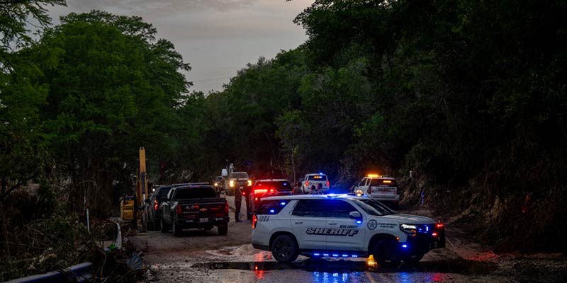
• Overnight July 3, torrential rains — up to 46 centimetres in a matter of hours — sent a wall of water surging through Kerr County’s Guadalupe River basin at around 4am, catching many residents and vacationers off guard.
• The US National Weather Service issued alerts – including a flash flood watch more than 12 hours in advance, upgraded to a flash flood emergency about three hours before impact.
• The warnings were disseminated by Weather Radio, emergency management systems and television and radio stations, but many people, including hundreds of children at summer camps, were not reached in time.
• Floodwaters surged dramatically as the Guadalupe River rose nearly 8 metres in about 45 minutes.
• Among the hardest hit was the all-girls summer camp, Camp Mystic, along the river, where at least 27 campers and counsellors died, according to media reports.
• One of the challenges was that the final warnings came as people were sleeping and there were no local sirens in the camps.
• Texas state authorities report that more than 160 people remain missing.
• The disaster has triggered one of the largest search-and-rescue efforts in state history.
The Texas disaster joins a string of recent catastrophic floods.
i) 2020 South Asian Floods: Affected over six countries, causing 6,511 fatalities and $105 billion in damages.
ii) 2022 Pakistan Floods: More than 1,700 casualties, 33 million people affected, with estimated losses of $40 billion.
iii) 2024 Europe, Middle East and Africa Floods: Resulted in $36 billion in economic damages.
WMO Action
• WMO supports countries in predicting flash floods through the Flash Flood Guidance System (FFGS) under Flood Forecasting Initiative (FFI), a real-time forecasting and early warning platform used in over 70 countries.
• This system integrates satellite precipitation, radar, and high-resolution numerical weather models to support forecasters in identifying local flash flood threats.
• The operational backbone includes a network of regional centres and national services trained to interpret and act on the guidance, often hours before rainfall-triggered flooding begins.
Common Alerting Protocol (CAP) in India
• The Union government has commissioned Common Alerting Protocol (CAP) based Integrated Alert System (SACHET) which is functional for disseminating alerts/early warnings.
• CAP platform integrates all alert generating agencies — India Meteorological Department (IMD), Central Water Commission (CWC), Indian National Centre for Ocean Information Services (INCOIS), Defence Geo-informatics Research Establishment (DGRE), Geological Survey of India (GSI) and Forest Survey of India (FSI) with all State Disaster Management Authorities (SDMAs) which are enabled to issue geo-targeted alerts/warning in regional vernacular by SMS, mobile app, browser alerts, and also over GAGAN and NavIC Satellite terminals.
• Apart from SACHET, a number of other mobile applications such as Damini, Mausam and Meghdoot have also been developed for timely dissemination of early warnings and alerts to the common people.
• Some state governments have also instituted early warning systems for specific hazards like lightning and floods.
• The Early Warning Dissemination System under National Cyclone Risk Mitigation Project (NCRMP) has been installed and commissioned in some states to provide reliable communication and ensure last mile connectivity during disasters.
Manorama Yearbook app is now available on Google Play Store and iOS App Store

