
- World
- Sep 07
- Sreesha V.M
UN votes to adopt new world map to reflect Africa’s true size
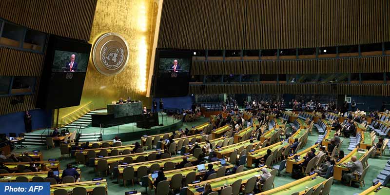
• The UN General Assembly endorsed a resolution promoting map projections that more accurately reflect the true size of continents.
• It was the culmination of an African-led campaign against the 16th-century Mercator projection, still the most widely used map in the world.
• It encourages governments, schools and tech companies worldwide to stop using maps that make Africa look far smaller than it really is.
• The resolution, titled ‘Correct the map: Rebalancing global cartographic representation and promoting equitable representation of the world’s regions, particularly Africa’, was adopted by a recorded vote of 164 in favour to one against.
• The United States cast the sole vote against, dismissing the initiative as part of a “radical ideological project”.
Mercator projection
• For centuries, map projections used in textbooks, the media, digital platforms and official documents have distorted the relative size of continents, symbolically diminishing Africa and other regions and perpetuating an unbalanced view of world geography.
• Gerardus Mercator, a Flemish cartographer, devised his projection in 1569 to solve a practical problem of maritime navigation.
• Because straight lines on his map correspond to constant compass directions, sailors could use it to plot their courses.
• But preserving direction came at the expense of the area. Landmasses appear increasingly enlarged the farther they are from the Equator.
• Greenland, for instance, can look roughly comparable in size to Africa, even though Africa is about 14 times larger.
• Northern Europe and North America are similarly magnified, relative to equatorial regions.
• Despite its original navigational purpose, Mercator remains common in educational, media, digital and official materials.
Correcting the world map
• Correcting the map means recognising that every region of the world deserves to be represented accurately and with dignity.
• The ‘Correct the Map’ resolution was sponsored by Togo and backed by African Union (AU) members.
• The resolution says those distortions have contributed to the “symbolic minimisation” of Africa and perpetuated an unbalanced view of the world.
• The resolution does not ban the Mercator projection or impose a replacement.
• Instead, it encourages governments, schools, international organisations and technology companies to use the Equal Earth projection and other so-called equal-area maps when relative size matters, and to teach the limitations of any flat map in representing a spherical planet.
• Togo led negotiations on behalf of the African group, building on a campaign backed by the African Union.
• The resolution itself acknowledges a fundamental problem that no vote can solve. No projection can perfectly reproduce the curved surface of the Earth on a plane. Each sacrifice something – area, shape, distance or direction – and each is suited to different purposes.
(The author is a trainer for Civil Services aspirants.)