- India
- Oct 31
NISAR to provide dynamic view of forests, wetlands
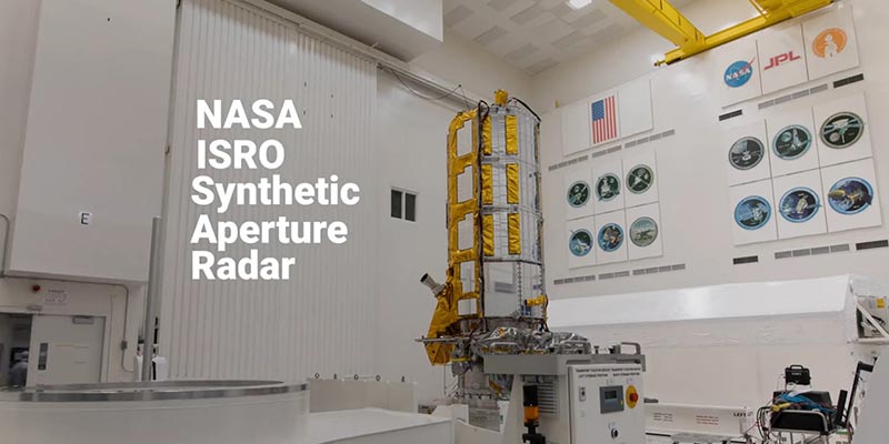
The ‘NASA-ISRO Synthetic Aperture Radar’ (NISAR) satellite will help researchers explore how changes in Earth’s forest and wetland ecosystems are affecting the global carbon cycle and influencing climate change.
What is NISAR?
• The NASA-ISRO Synthetic Aperture Radar (NISAR) is a joint Earth-observing mission between NASA and ISRO with the goal to make global measurements of the causes and consequences of land surface changes using advanced radar imaging.
• On September 30, 2014, NASA and ISRO signed a partnership to collaborate on and launch NISAR.
• NISAR is planned to launch in 2024 from Satish Dhawan Space Center in Sriharikota into a near-polar orbit.
• The NISAR satellite is designed to observe and take measurements of some of the planet’s most complex processes. These include ecosystem disturbances, ice-sheet collapse, and natural hazards such as earthquakes, tsunamis, volcanoes and landslides.
• Once it launches in early 2024, the NISAR radar satellite mission will offer detailed insights into two types of ecosystems — forests and wetlands — vital to naturally regulating the greenhouse gases in the atmosphere that are driving global climate change.
• When in orbit, NISAR’s sophisticated radar systems will scan nearly all of Earth’s land and ice surfaces twice every 12 days.
• The data it collects will help researchers understand two key functions of both ecosystem types — the capture and the release of carbon.
• Forests hold carbon in the wood of their trees, wetlands store it in their layers of organic soil. Disruption of either system, whether gradual or sudden, can accelerate the release of carbon dioxide and methane into the atmosphere.
• Tracking these land-cover changes on a global scale will help researchers study the impacts on the carbon cycle, the processes by which carbon moves between the atmosphere, land, ocean, and living things.
Tracking Deforestation
• Forestry and other land-use changes account for about 11 per cent of net human-caused greenhouse gas emissions. NISAR’s data will improve our understanding of how the loss of forests around the world influences the carbon cycle and contributes to global warming.
• The signal from NISAR’s L-band radar will penetrate the leaves and branches of forest canopies, bouncing off the tree trunks and the ground below.
• By analysing the signal that reflects back, researchers will be able to estimate the density of forest cover in an area as small as a soccer field.
• With successive orbital passes, it will be able to track whether a section of forest has been thinned or cleared over time. The data – which will be collected in early morning and evening and in any weather – could also offer clues as to what caused the change, such as disease, human activity, or fire.
• It’s an important set of capabilities for studying vast, often cloud-covered rainforests such as those in the Congo and Amazon basins, which lose millions of wooded acres every year.
• Fire releases carbon into the air directly, while the deterioration of forests reduces the absorption of atmospheric carbon dioxide.
Monitoring Wetland Flooding
• Wetlands present another carbon puzzle: Swamps, bogs, peatlands, inundated forests, marshes, and other wetlands hold 20 to 30 per cent of the carbon in Earth’s soil, despite constituting only 5 to 8 per cent of the land surface.
• When wetlands flood, bacteria go to work digesting organic matter (mostly dead plants) in the soil. Through this natural process, wetlands are the planet’s largest natural source of the potent greenhouse gas methane, which bubbles to the water’s surface and travels into the atmosphere.
• Meanwhile, when wetlands dry out, the carbon they store is exposed to oxygen, releasing carbon dioxide.
• NISAR will be able to monitor flooding, and with repeated passes, researchers will be able to track seasonal and annual variations in wetlands inundation, as well as long-term trends.
• By coupling NISAR’s wetlands observations with separate data on the release of greenhouse gases, researchers should gain insights that inform the management of wetland ecosystems.
Manorama Yearbook app is now available on Google Play Store and iOS App Store


